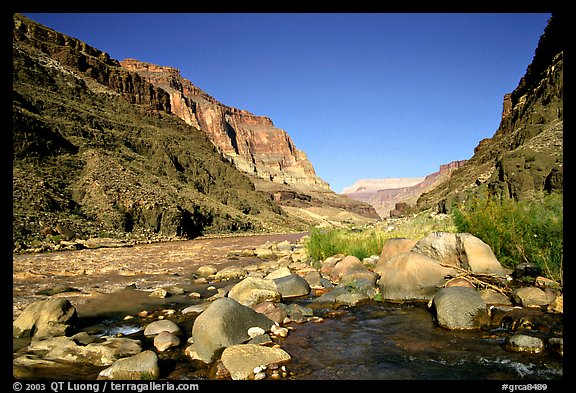
Last night, our floating fellas camped out beneath the overlook at Toroweap. I know, because at 10:12pm (our time; 8:12 their time) my Dad called and told us so. It was just about the only thing he told us before the satellite connection gave out. That beach in the picture below? We’re pretty sure that is where they camped.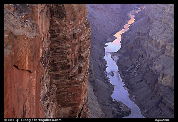 If you’ve been to my parents house and seen THE POSTERS, you’ve seen Toroweap. A huge photographic poster of Toroweap overlook hangs among the 7 million or so other National Park posters of all sizes hung in an incredible mosaic style within an inch of each other, filling every inch of wall, all the way up to the peaked, raised ceiling on two sides of the room. How they hung the posters is a marvel so impressive, it sits right up there with the building of the Hoover Dam. Delicate Arch, my Dad’s most favorite monument, holds the crown position at the top. But Toroweap is there, too, and hard to miss. Even in pictures, it’s a striking view.
 When my parents visited the North Rim (their words: “if you can only go once, skip the South Rim and see the North”) they hiked to Toroweap Point and hung around playing chicken with the canyon edge. (I’ve seen the pictures. They were crazy. One strong gust would have been very unlucky for them on that day.) At some point, they noticed rafts coming down the river and hiked down the side of Toroweap to watch the rafts at Lava Falls. They noticed the camps on the river and watched the leaders pull over the scout the rapids. My Mom says that you could hear Lava Falls from Toroweap, growing louder as they descended. Here is another account:
I looked over an edge and down into a 3,000-foot-deep chasm. I had never seen anything so large or so deep, and in my joy began dancing atop a slab of rock, inches from perdition. It was the happiest brush with death I’ll ever have.
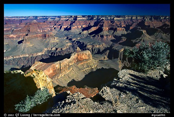
At the overlook there, the Grand Canyon simplifies itself. Instead of the busy look the canyon has upstream, with dozens of tributaries cutting down to the Colorado River, and a tumult of mesas crowding around the inner gorge, here the canyon is a simple cut in the earth with some mesas and buttes back from the edge. The river flows between vertical walls that are twice the height of the Sears Tower in Chicago, and you can look straight down upon it. Depending on the wind and the day, you can hear the river, usually as a distant whisper. The irony of that soft sound isn’t lost on you: The Colorado at this point has Class 5 rapids, the toughest ones rafters can face. They flow over the remnants of a 600-foot-high natural dam created by a volcanic eruption thousands of years before. The dam backed the Colorado up and created a vast lake that lasted for years. But the Colorado eventually tore down the dam, eroding and wedging it apart, and slamming big boulders into it during floods. Yet from a vantage 3,000 feet above it, this ferocious natural force seemed placid and purring.
With nothing to obstruct your view into the inner gorge, Toroweap is probably the best place in the national park to get a sense of how big the Grand Canyon is. Further east at South or North Rim, you can sense its vastness in a more panoramic manner. The canyon sprawls before you, impressing with its horizontal size, but it never quite gives you an adequate sense of its vertical scale. At Toroweap, the drop is so deep and dramatic that you finally “get it.” There are bigger places on earth than Toroweap – the glaciers of Alaska come to mind, as well as the enormous mass of Mt. McKinley – but none can give a stronger impression of sheer immensity.
My Mom’s take is similar, although in her words, the sound of Lava Falls is a roar: “and I mean, hear the ROAR.” Last night, I imagine that Dad, Paul, and Skip fell asleep to that sound.
So, their day’s itinerary: “Day 7: 178-222 mile. Lava falls, last night.”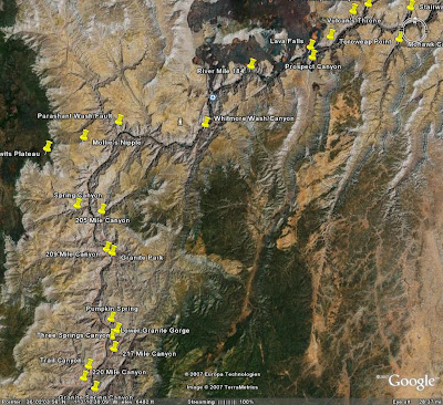 This is a geologic explanation of Lava Falls:
Prospect Canyon is of particular interest. It has been filled several times with lava flows and is only just starting to erode a new canyon down to the river. Also, these lava flows sit right on the fault line, and each time the fault moves, it shatters some of the old lava. The watershed for the canyon extends some 20 miles further south, which means a large amount of water can come down the canyon during a flash flood. The combination of large amounts of water, shattered rock, and a steep drop to the bottom of the Grand Canyon allows large volumes of debris to pile up where it meets the Colorado River. The result is Lava Falls Rapid.
Most of the Prospect Canyon debris fan was deposited in a huge debris flow about 3,000 years ago. This river blockage is responsible for Lava Falls Rapid and also backed up the Colorado River for at least 20 miles. River gradient is still relatively low for 20 miles upstream.
Prior to 1939 it was debatable whether Lava Falls or Hance Rapid was the “baddest” on the river. Then another debris flow (estimated at 35,000 cu. ft. per sec.) down Prospect added to the debris fan and settled the issue. In 1966 a major debris flow down Crystal Creek created Crystal Rapid and once again there is a “baddest” debate. Prospect Canyon had another debris flow on March 6, 1995 that constricted Lava Falls Rapid again, but not enough to settle the issue. As to which rapid will become the worst – stay tuned. It might happen just as you start a future raft trip.
I have never rafted in white water so I really don’t have a strong sense of the experience. I do however, have a hefty amount of respect for what could happen, and enough fear to keep me in line. To me, all the pictures and stories just make it sound like a seriously good time. Reading this — riding with the same company Dad-n-Sons are with! — helped.
 They are camped at mile 222 tonight. I know this because they called! Twice! The conversations lasted a bit longer this time, but not much. First conversation was with my Dad, the second was with Paul.
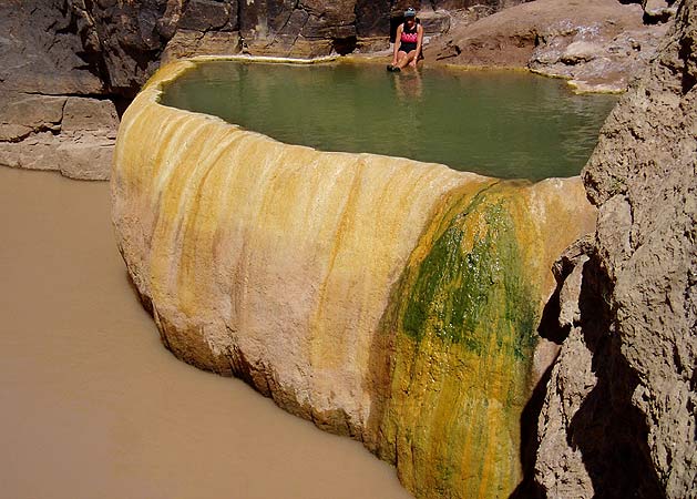 — They wanted to know where the helicopter pad was that we landed on in 2004. [Backstory: one of my Dad’s Naval Academy classmates runs a helicopter company out of Las Vegas. In May of 2004, all seven of us (Mom, Dad, me, Paul, Skip, Emily, and a six-month old Will) flew out to Las Vegas and took an all day tour. We had lunch in the Grand Canyon, flew over Bryce, and then over Zion… including an incredible fly-over of the Narrows and right over Angel’s Landing. It was spectacular.] I’d plotted the helipad the night before and was able to look on Google Earth and figure out the location for them. They’ll pass it tomorrow.