The family’s City Slickers had “big rapid day” today. This is the complete description from the guide. They went from about mile 75-120.  I found this amazing website that helped piece together the maps below. Google earth actually picked up some of the white water from a few of the rapids, so here are so close-ups to check it out.
  Map above — they passed by the main Grand Canyon National Park Visitor’s Center on the South Rim. Also, they went under the bridge that connects North and South Rims and allows visitors to travel from the South Rim to Phantom Ranch, which is located up Bright Angel Creek. When we descended the Canyon back in ’94, we did not go down as far as the Colorado (just a day trip) but we went far enough to see the river… taking Bright Angel Trail the whole way.
 These two points off of Tonto Plateau are two of the most famous for big canyon views… pictures further below.
 More of their trip today…
 Views from Pima Point from NPS.
  Elves Chasm…I don’t know if they hiked here, but it is a well-loved spot along their path.
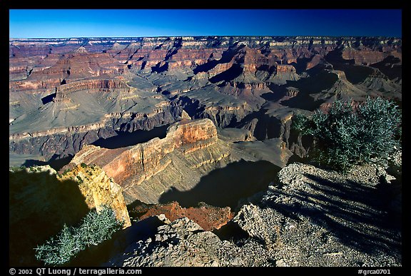 From Hopi Point
 View of the River from Hopi Point.
Side note: Dad took a satellite phone on the insistence of work… we thought they’d call us at some point on the trip, if the phone functioned. My guess would have been that today would have been the most likely range for the phone to pick up a signal. No call!


Post a Comment