 Based on the brief conversation I had with my Dad before the phone gave up its signal, they started the day about three miles east of Deer Creek and were going to hike the Creek and Narrows. (Narrows are falls are pictured below.)
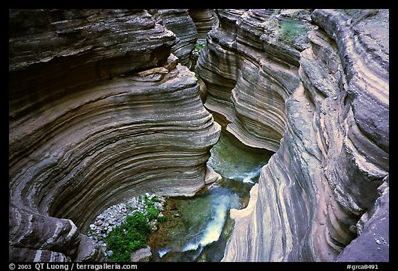
 Here’s the gouge:
A popular hike for rafting groups is to climb up from the river at the base of Deer Creek Falls to at least reach the open valley above the falls (small green area near the lower edge). As the trail zigzags up out of the schist and Tapeats Sandstone that forms the cliff next to the river, a spectacular view unfolds. (“Throat clutching view” might be equally descriptive.) If you continue to follow the creek up to Deer Spring, you get to see another large waterfall where the stream bursts out of a cave system in the limestone cliffs.
The trail up from the river uses a slope that is the result of a large slump (very slow motion landslide). Water is able to seep down through the broken material of the slump while the underlying solid rock keeps the water near the surface. As a result vegetation (including one of the few locations that Poison Ivy exists in the canyon) is able to grow in areas several hundred feet away from the river.
The poison ivy part has me a tinsey bit concerned for Paul (he gets poison ivy out of thin air) but I don’t think there is any real reason to worry. How could you when you’re in the middle of all this??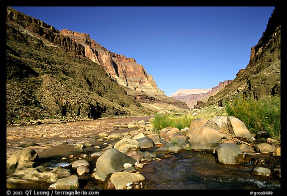 (Side note: this is of Tapeats Creek confluence with the Colorado, which they saw either early Monday or Late Sunday.)


Post a Comment