Driving back from Mississippi this afternoon, we decided to take more scenic US 90 into town.
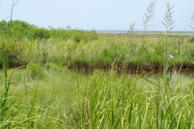
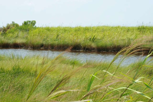
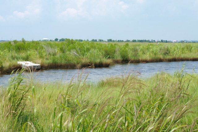
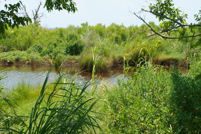
The photos below come from less than a quarter mile southwest of Fort Pike. (The “A” marks Fort Pike.)
Here is the map closer in — the photos come from about where the “90” is on the map, between Lake Saint Catherine and Lake Pontchartrain.
For orientation, the I-10 bridge over the Lake is visible in the background of several of these photos. These were taken over a span of a few hundred feet along US 90.
I’m not an expert in environment, oil, or marshland ecosystems. Nor was I searching for a smoking gun. But this does not look right to me.
This part of the marsh looked a lot different than the rest.
Tell me it’s a normal look. Tell me that the green isn’t there temporarily (these photos are not photoshopped). Can someone who knows more about these things tell me that this is a healthy marsh? I honestly don’t know.


judyb | 13-Jul-10 at 9:34 am | Permalink
Great pictures! My husband and I love our Highway 90 treks! Here’s a link to some pictures we’ve taken in the past
http://thanks-katrina.blogspot.com/search?q=highway+90
enjoy!
judyb | 13-Jul-10 at 9:38 am | Permalink
Woops! I was so busy looking at the pictures I missed your comments. I certainly hope the darkness on the bottom of those plants is normal.
holly | 14-Jul-10 at 9:27 pm | Permalink
Thanks for your link! Compared to the surrounding plants, these looked very very different. I have a hard time thinking it is anything but oil staining… it seemed clear to Paul and I when we saw it.
Sue Rowland | 15-Jul-10 at 5:46 pm | Permalink
How about pictures of the same areas in a couple of months? That will tell us more about the effects of the oil.
Melanie | 15-Jul-10 at 6:34 pm | Permalink
My husband grew up around the marsh and I showed him the pics. He said it was hard to tell in the pictures, but it looks normal to him. He doesn’t think it’s oil related.
holly | 15-Jul-10 at 6:43 pm | Permalink
Thanks, Melanie! It is really hard to tell. Compared to the surrounding marsh, this look REALLY STRANGE. Very high line of darkness across the marsh. The pictures don’t even really do it justice. Darkness from water line is normal in marsh, but this was WAY high compared to the surrounding areas, and so clearly marked. And it would have dried out by then that high up on the reeds. It looks very clearly like oil (and the air smelled off) but I can’t be sure… I’m no expert in what oil lines look like.
holly | 15-Jul-10 at 6:43 pm | Permalink
Yes, I think we need to go back and check it out when we can get a chance. I’m very curious.